OUTINGS TO EXPLORE THE PUENTE-CHINO HILLS WILDLIFE CORRIDOR
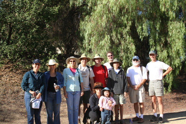
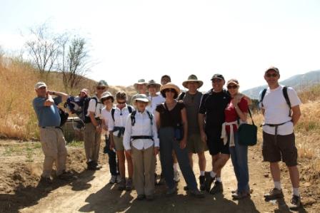
Join us on any of these hikes and become familiar with everything our hills have to offer. The Puente-Chino Hills Task force (PCHTF), a group within the Sierra Club, organizes these hikes. The PCHTF is working towards the preservation of the Wildlife Corridor as an island of beauty and biological significance in a sea of urbanization.
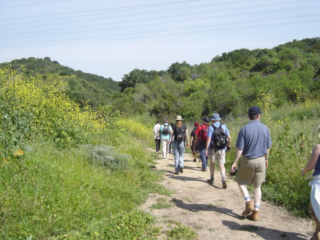
The hikes should appeal to people who want to stay in shape, are eager to enjoy the outdoors, and want more information about their hills and its wildlife.
Hikes for 2024/2025
To download the Hikes Click Here
To go to our Meetup page Click Here
DETAILED HIKE DESCRIPTIONS
Powder Canyon (Rowland Heights): October 19th at 9am
Enjoy a 4.5 mi, 680-foot gain hike and info about the Powder Canyon Significant Ecological Area. Meet 9 am at the Powder Canyon entrance (equestrian ring) along Old Fullerton Rd , 400 yards W of Harbor Blvd (near Pathfinder) in La Habra Heights. Parking is limited so you may have to park on Fullerton Road and walk to the ring. Bring water, a snack, and sturdy shoes. Rain within 48 hours cancels. Leaders: Fred Reed and Eric Johnson, 714 325-2710 Note: Take note to find the right parking lot. This is the Old Fullerton Rd/Harbor Blvd intersection in La Habra Heights, near 2345 Fullerton Rd, La Habra Heights, not the more southern Fullerton Rd/Harbor Blvd intersection.
(GPS: 33 57'51"N, 117 55'18"W) (33.964 N,117.922 W)
Lower Aliso Canyon Trail Trail (CHSP - Chino Hills): November 23rd at 9am
Enjoy a hike along a ridge and through this gentle sloping valley. This is a 7 mile, 800 ft gain hike. Meet 9 am at the park headquarters at the Rolling M Ranch Barn. Ridesharing encouraged, $10 fee for parking. Bring water, snack, and sturdy shoes. Rain within 48 hours cancels. Leaders: Eric Johnson, Fred Reed, 714 325-2710
(GPS: 33 55'25"N, 117 42'22"W) (33.923, 117.706)
Note: The park is located 10 miles northwest of Corona. Take the 91-Freeway to Highway 71-North, turn left at Soquel Canyon. Proceed to Elinvar and turn left. Elinvar merges into Sapphire to the left, the park entrance is located on the right at 4721 Sapphire Road. Drive into the park from the entrance up the 3 mile road to the Barn, which takes 15 minutes.
Gilman Peak (CHSP - Yorba Linda): December 14th at 9am
We'll ascend to Gilman peak with a stunning 360° view. This is a 6 mile, 1,200' gain hike including some very steep sections. Meet 9 am at Rim Crest Dr. in Yorba Linda (park on NE side, note parking warnings). Bring water, a snack, and sturdy shoes. Rain within 48 hours cancels. Leaders: Fred Reed, 714 325-2710, Eric Johnson
(GPS: 33 54'31"N, 117 46'49"W) (33.909 N, 117.780 W)
La Vida Trail (CHSP - Brea): January 18th at 9am
Hike a remote and relatively unknown loop through the back hills of Brea in the Chino Hills State Park. A 4.5 mile loop, 1000 foot gain, along a trail crossing Sonome Creek. Meet 9 am in Olinda Village at 200 Verbena Ln (and Olinda Dr, not Place); off Carbon Canyon Rd) Bring water, a snack, and sturdy shoes. Rain within 48 hours cancels. Leaders: Eric Johnson and Fred Reed , 714 325-2710
(GPS: 33 55'49"N, 117 48'13"W) (33.930 N, 117.804 W)
Rimcrest (CHSP - Yorba Linda): February 22nd at 9am
Join us on a hike as we travel along a ridgeline and shaded valley in Chino Hills State Park. This is a 7 mile 950' gain hike. Meet 9 am at Rim Crest Dr. in Yorba Linda (park on NE side, note parking warnings). Bring water, a snack, and sturdy shoes. Rain within 48 hours cancels. Leaders: Fred Reed, 714 325-2710, Eric Johnson
(GPS: 33 54'31"N, 117 46'49"W) (33.909 N, 117.780 W)
Skyline Trail/Buddhist Temple (Hacienda Heights): March 22nd at 10am
A leisurely hike with a couple of steep sections along the ridge between La Habra Heights and Hacienda Heights, with lunch at the turnaround point of the Buddhist Temple on Hacienda Blvd. A 1,000 foot gain over 4 miles through walkways under Colima and Hacienda Blvds. Meet 10:00 AM. Park on S. Holmes Circle between S. Hermitage Dr and E. Cargreen Ave. Vegetarian lunch ($10) with time to look around the largest Buddhist temple in the Western Hemisphere. Bring water, and sturdy shoes. No tank tops/sleeveless or shorts allowed onto the temple grounds. Leaders: Fred Reed, Eric Johnson 714 325-2710
(GPS: 33 58'45"N, 117 59'17"W) (33.979 N, 117.988 W)
Seventh Avenue Trail (Hacienda Heights): April 12th at 9am
Hike with us in the hills of Hacienda Heights with great views of the San Gabriel Mtns. 5 mi, 1,100' gain. The preservation of this land launched the Habitat Authority effort. Meet 9 am at 7th Ave and E. Orange Grove Ave, Hacienda Heights. Bring water, snacks, and sturdy shoes. Rain within 48 hours cancels. Co-leaders: Fred Reed and Eric Johnson, c 714 325-2710 14600 Orange Grove Ave, Hacienda Heights, CA
(GPS: 34 00'34.89 N, 117 59'38.45"W) (34.011 N, 117.997 W)
East Fence Line Trail (CHSP - Chino Hills): May 17th at 9am
We'll start at the CHSP headquarters at the Rolling M Ranch barn, and for 6 miles and 1,000 feet vertical; hike the hills and valleys to the east with some great views both of the park and east into Corona. Meet 9 am. Ridesharing encouraged, $10 fee for parking. Bring water, snacks, and sturdy shoes. Rain within 48 hours cancels. Leaders: Fred Reed, 714 325-2710, Eric Johnson
(GPS: 33 55'25"N, 117 42'22"W) (33.923, 117.706)
Note: The park is located 10 miles northwest of Corona. Take the 91-Freeway to Highway 71-North, turn left at Soquel Canyon. Proceed to Elinvar and turn left. Elinvar merges into Sapphire to the left, the park entrance is located on the right at 4721 Sapphire Road. Drive into the park from the entrance up the 3 mile road to the Barn, which takes 15 minutes.
GENERAL INFORMATION
The GPS coordinates are listed for each trailhead.
For all hikes, please bring good walking shoes (lug soles recommended), water, a snack, and sunscreen and/or a hat.
For more information regarding these hikes, please contact the leaders:
Fred Reed: cell 714 325-2710; fkreed@msn.com
Eric Johnson: cell 714 366-6571; ericsj@mindspring.com
Join us on any of these hikes and become familiar with everything our hills have to offer. The Puente-Chino Hills Task force (PCHTF), a group within the Sierra Club, organizes these hikes. The PCHTF is working towards the preservation of the Wildlife Corridor as an island of beauty and biological significance in a sea of urbanization.
The hikes should appeal to people who want to stay in shape, are eager to enjoy the outdoors, and want more information about their hills and its wildlife.
Hikes for 2024/2025
| Powder Canyon (Rowland Heights) | Oct 19 | |
| Lower Aliso Canyon Trail (CHSP) | Nov 23 | |
| Gilman Peak (CHSP) | Dec 14 | |
| La Vida Trail (CHSP - Brea) | Jan 18 | |
| Rim Crest (CHSP) | Feb 22 | |
| Skyline Trail/Buddhist Temple (Hacienda Heights) | Mar 22 | 10 AM |
| Seventh Avenue (Hacienda Heights) | Apr 12 | |
| East Fence Line Trail (CHSP) | May 17 |
To download the Hikes Click Here
To go to our Meetup page Click Here
DETAILED HIKE DESCRIPTIONS
Powder Canyon (Rowland Heights): October 19th at 9am
Enjoy a 4.5 mi, 680-foot gain hike and info about the Powder Canyon Significant Ecological Area. Meet 9 am at the Powder Canyon entrance (equestrian ring) along Old Fullerton Rd , 400 yards W of Harbor Blvd (near Pathfinder) in La Habra Heights. Parking is limited so you may have to park on Fullerton Road and walk to the ring. Bring water, a snack, and sturdy shoes. Rain within 48 hours cancels. Leaders: Fred Reed and Eric Johnson, 714 325-2710 Note: Take note to find the right parking lot. This is the Old Fullerton Rd/Harbor Blvd intersection in La Habra Heights, near 2345 Fullerton Rd, La Habra Heights, not the more southern Fullerton Rd/Harbor Blvd intersection.
(GPS: 33 57'51"N, 117 55'18"W) (33.964 N,117.922 W)
Lower Aliso Canyon Trail Trail (CHSP - Chino Hills): November 23rd at 9am
Enjoy a hike along a ridge and through this gentle sloping valley. This is a 7 mile, 800 ft gain hike. Meet 9 am at the park headquarters at the Rolling M Ranch Barn. Ridesharing encouraged, $10 fee for parking. Bring water, snack, and sturdy shoes. Rain within 48 hours cancels. Leaders: Eric Johnson, Fred Reed, 714 325-2710
(GPS: 33 55'25"N, 117 42'22"W) (33.923, 117.706)
Note: The park is located 10 miles northwest of Corona. Take the 91-Freeway to Highway 71-North, turn left at Soquel Canyon. Proceed to Elinvar and turn left. Elinvar merges into Sapphire to the left, the park entrance is located on the right at 4721 Sapphire Road. Drive into the park from the entrance up the 3 mile road to the Barn, which takes 15 minutes.
Gilman Peak (CHSP - Yorba Linda): December 14th at 9am
We'll ascend to Gilman peak with a stunning 360° view. This is a 6 mile, 1,200' gain hike including some very steep sections. Meet 9 am at Rim Crest Dr. in Yorba Linda (park on NE side, note parking warnings). Bring water, a snack, and sturdy shoes. Rain within 48 hours cancels. Leaders: Fred Reed, 714 325-2710, Eric Johnson
(GPS: 33 54'31"N, 117 46'49"W) (33.909 N, 117.780 W)
La Vida Trail (CHSP - Brea): January 18th at 9am
Hike a remote and relatively unknown loop through the back hills of Brea in the Chino Hills State Park. A 4.5 mile loop, 1000 foot gain, along a trail crossing Sonome Creek. Meet 9 am in Olinda Village at 200 Verbena Ln (and Olinda Dr, not Place); off Carbon Canyon Rd) Bring water, a snack, and sturdy shoes. Rain within 48 hours cancels. Leaders: Eric Johnson and Fred Reed , 714 325-2710
(GPS: 33 55'49"N, 117 48'13"W) (33.930 N, 117.804 W)
Rimcrest (CHSP - Yorba Linda): February 22nd at 9am
Join us on a hike as we travel along a ridgeline and shaded valley in Chino Hills State Park. This is a 7 mile 950' gain hike. Meet 9 am at Rim Crest Dr. in Yorba Linda (park on NE side, note parking warnings). Bring water, a snack, and sturdy shoes. Rain within 48 hours cancels. Leaders: Fred Reed, 714 325-2710, Eric Johnson
(GPS: 33 54'31"N, 117 46'49"W) (33.909 N, 117.780 W)
Skyline Trail/Buddhist Temple (Hacienda Heights): March 22nd at 10am
A leisurely hike with a couple of steep sections along the ridge between La Habra Heights and Hacienda Heights, with lunch at the turnaround point of the Buddhist Temple on Hacienda Blvd. A 1,000 foot gain over 4 miles through walkways under Colima and Hacienda Blvds. Meet 10:00 AM. Park on S. Holmes Circle between S. Hermitage Dr and E. Cargreen Ave. Vegetarian lunch ($10) with time to look around the largest Buddhist temple in the Western Hemisphere. Bring water, and sturdy shoes. No tank tops/sleeveless or shorts allowed onto the temple grounds. Leaders: Fred Reed, Eric Johnson 714 325-2710
(GPS: 33 58'45"N, 117 59'17"W) (33.979 N, 117.988 W)
Seventh Avenue Trail (Hacienda Heights): April 12th at 9am
Hike with us in the hills of Hacienda Heights with great views of the San Gabriel Mtns. 5 mi, 1,100' gain. The preservation of this land launched the Habitat Authority effort. Meet 9 am at 7th Ave and E. Orange Grove Ave, Hacienda Heights. Bring water, snacks, and sturdy shoes. Rain within 48 hours cancels. Co-leaders: Fred Reed and Eric Johnson, c 714 325-2710 14600 Orange Grove Ave, Hacienda Heights, CA
(GPS: 34 00'34.89 N, 117 59'38.45"W) (34.011 N, 117.997 W)
East Fence Line Trail (CHSP - Chino Hills): May 17th at 9am
We'll start at the CHSP headquarters at the Rolling M Ranch barn, and for 6 miles and 1,000 feet vertical; hike the hills and valleys to the east with some great views both of the park and east into Corona. Meet 9 am. Ridesharing encouraged, $10 fee for parking. Bring water, snacks, and sturdy shoes. Rain within 48 hours cancels. Leaders: Fred Reed, 714 325-2710, Eric Johnson
(GPS: 33 55'25"N, 117 42'22"W) (33.923, 117.706)
Note: The park is located 10 miles northwest of Corona. Take the 91-Freeway to Highway 71-North, turn left at Soquel Canyon. Proceed to Elinvar and turn left. Elinvar merges into Sapphire to the left, the park entrance is located on the right at 4721 Sapphire Road. Drive into the park from the entrance up the 3 mile road to the Barn, which takes 15 minutes.
GENERAL INFORMATION
The GPS coordinates are listed for each trailhead.
For all hikes, please bring good walking shoes (lug soles recommended), water, a snack, and sunscreen and/or a hat.
For more information regarding these hikes, please contact the leaders:
Fred Reed: cell 714 325-2710; fkreed@msn.com
Eric Johnson: cell 714 366-6571; ericsj@mindspring.com